While it is best not to plan too much since this maximizes fun and chances to learn from your mistakes, it is also a good idea to bring some necessities. What you should bring depends greatly on where you might be going, what season it is, and how long you are leaving. As a rule of thumb, I try to pack the following items:
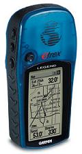
| Garmin Etrex Legend
This cheap GPS unit is very useful since it displays a
general outline of the local main arteries. It also acts as a compass,
displays your average speed, and leaves a trail of bread crumbs for when
you get lost in the forest like Hansel and Gretel. I did not know how
useful it was until I was lost in the Pisgah National Forest and it
showed me the way out. You NEED a compass because parts of this country
look the same no matter which direction you are heading and you cannot
count on the sun or the stars if it's cloudy or while under a thick
canopy. Another good use for the Etrex is to show you your progress on
the road. I prop it up, wedging it between the windshield and the dash,
and keep an eye on when the next town is coming up. It also lists
services like gas and food at each Interstate exit. I never leave into
the unknown
without it anymore. |
 |
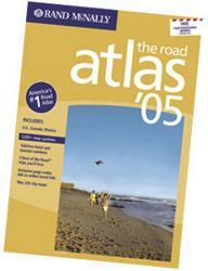
| Rand McNally Road Atlas
At stores like Wal-mart or at some truck stops you can
pick this up for about $5 and it is the best $5 you can spend. I prefer
the large type one and one with binder rings is always better. I abuse
my atlas so much that it never really lasts through more than two trips.
These atlases have the clearest and most accurate depictions of major
roads in an area. Rand McNally maps are the best for traveling along the
Interstate and list every exit accurately. City maps, mileage guides,
and other information in the book is also very useful. They used to even
have a toll road guide that told you how much each road costs to travel.
While driving, I keep mine open to the correct page between me and the
car door for quick access. |
 |
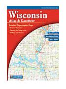
| DeLorme State Atlases
These atlases are a bit more expensive and
should not be man-handled like the Rand McNally. These display every town
(former and present), every back road, exact locations of campgrounds
and geographic features, show topography (important for planning your
travel time), and even list local landmarks like towers and electric lines.
With a GPS and a DeLorme atlas, you will never be hopelessly lost. The
maps are uniform and make local planning a breeze. It is not good to
read this kind of map while driving and it is not useful for Interstate
travel since you will have to turn pages too often, but is great for
those blue highways. It is always wise to know when your concrete road
might become a strip of gravel. |
 |
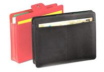
| Pouch for local information
Do not just throw it up on the sun visor like me.
Especially for long trips, stay organized. You will collect a lot of
free local maps at rest stops and welcome centers that are essential to
local travel, especially through towns and cities. You need a good place
to store any directions and notes you made before the trip began. Keep
your information in ONE place so you will know where it is when you need
it. When you have passed an area, do not be afraid to throw stuff out
that you don't need anymore. The mess can build quickly. |
 |